
Unprecedented U.S.–India Collaboration in Earth Observation
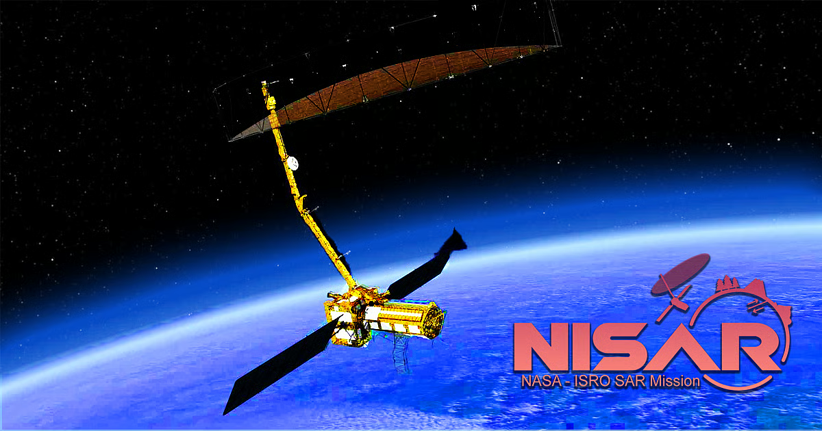
On Monday, July 28 2025, the NASA-ISRO Synthetic Aperture Radar (NISAR) satellite lifts off aboard ISRO’s GSLV-F16 from Satish Dhawan Space Centre in Sriharikota, marking the culmination of more than ten years of joint development between NASA and the Indian Space Research Organisation (ISRO). NISAR represents the first equal-partner Earth-observation mission between the two agencies, combining NASA’s L‑band and ISRO’s S‑band radars on a single platform.
Dual-Frequency SAR for All-Weather, Day-Night Imaging
NISAR’s dual-frequency synthetic aperture radar (SAR) payload comprises:
- NASA’s L‑band radar (24 cm wavelength), capable of penetrating vegetation and soil
- ISRO’s S‑band radar (9.3 cm wavelength), optimized for monitoring moisture and surface features
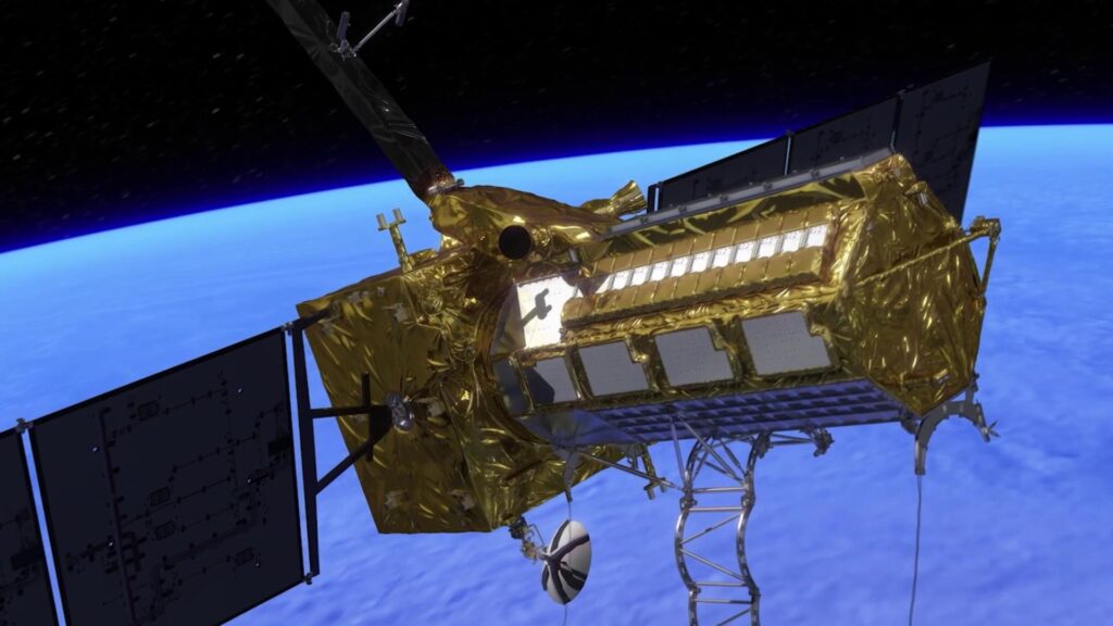
These complementary radars share a 12 m deployable mesh reflector antenna, enabling high-resolution imaging through clouds and darkness. Together, they will scan nearly all of Earth’s land and ice surfaces twice every 12 days, generating approximately 80 TB of data per day for scientific and operational use.
SweepSAR Technology and Global Coverage
Using SweepSAR technology, NISAR achieves a swath width of 242 km with spatial resolutions between 5 and 10 m. Its Sun-synchronous orbit at 743 km altitude and 98.4° inclination allows consistent revisit intervals and repeat-pass interferometry, essential for measuring ground deformation, ice-sheet dynamics, and vegetation changes at sub-centimeter precision.
Key Science Objectives and Applications

NISAR’s data will support a broad array of disciplines and applications:
- Natural hazard monitoring: Detect subtle land movements preceding earthquakes, landslides, and volcanic eruptions, improving early warning systems.
- Cryosphere studies: Track Antarctic and Arctic ice-sheet retreat and glacier flow to refine climate models.
- Ecosystem assessment: Map forest structure, wetland dynamics, and soil moisture changes for resource management and agricultural planning.
- Disaster response: Provide near-real-time imagery to aid emergency relief during floods, wildfires, and storm surges.
Engineering Milestones and Decade-Long Development
The NISAR project epitomizes international cooperation:
- NASA supplied the L‑band SAR, high-rate telemetry, GPS receivers, and payload data subsystems.
- ISRO provided the S‑band SAR, satellite bus, solar arrays, and the GSLV-F16 launch vehicle.
- Overcoming design challenges—such as antenna thermal coatings—required iterative testing between JPL and ISRO teams, culminating in final integration at Satish Dhawan in May 2025.
Impact and Data Accessibility
With an estimated mission cost of US $1.5 billion, NISAR is poised to be the world’s most expensive and capable Earth-imaging radar satellite. All data will be freely available within 24 hours of acquisition (and within hours during emergencies), democratizing access for researchers, governments, and commercial entities worldwide.
As NISAR embarks on its scientific journey, it stands as a testament to the power of sustained international collaboration in addressing global challenges—from climate change to disaster resilience—using cutting-edge radar technology.
Leave a Reply